


IT-211

SityTrail - itinéraires balisés pédestres
Tous les sentiers balisés d’Europe GUIDE+
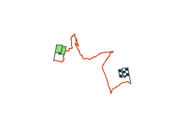

Length
10.2 km

Max alt
1842 m

Uphill gradient
441 m
Km-Effort
16.3 km

Min alt
1537 m

Downhill gradient
499 m
Boucle
No

Signpost
Creation date :
2022-02-14 21:39:55.809
Updated on :
2022-02-28 13:26:57.891
3h42
Difficulty : Easy

FREE GPS app for hiking
 SityTrail
IGN / Geographical institutes
SityTrail Plus
The world is yours!
About
Trail On foot of 10.2 km to be discovered at Friuli Venezia Giulia, Unknown, Forni di Sopra. This trail is proposed by SityTrail - itinéraires balisés pédestres.
Description
Trail created by Club Alpino Italiano.
Positioning
Country:
Italy
Region :
Friuli Venezia Giulia
Department/Province :
Unknown
Municipality :
Forni di Sopra
Location:
Unknown
Start:(Dec)
Start:(UTM)
312805 ; 5146998 (33T) N.
Comments